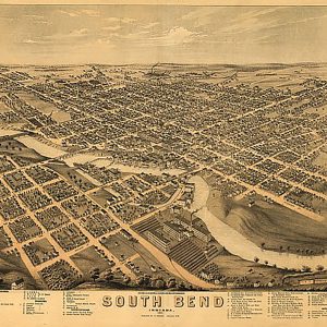

South Bend, Indiana by A. Ruger, 1874 For Cheap
$19.98South Bend, Indiana by A. Ruger, 1874This beautiful antique map reproduction is printed on heavy acid-free stock with fade proof inks and is excellent for framing. 28 W x 22 H
FREE RETURNS. STANDARD SHIPPING ORDERS $99+
Showing 1361–1376 of 5124 results
South Bend, Indiana by A. Ruger, 1874This beautiful antique map reproduction is printed on heavy acid-free stock with fade proof inks and is excellent for framing. 28 W x 22 H
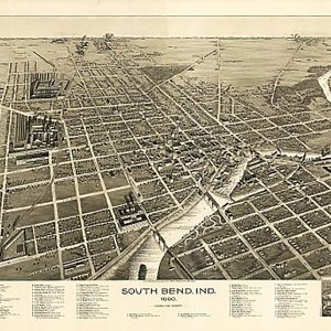
South Bend, Indiana by C. J. Pauli, 1890This beautiful antique map reproduction is printed on heavy acid-free stock with fade proof inks and is excellent for framing. 34 W x 23 H
Laminated with Hanging Rails 60 W x 46 H Index of Counties and Cities Fully Indexed Counties, Cities, Mileage Chart Inset Maps of All Major Cities Free Shipping! This map is rolled and shipped in a sturdy cardboard tube.
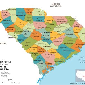
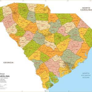
This map has been created and designed for reference or business use. Clear and clean colors & fonts matched with cartographic research makes this map of South Carolina Counties Map easily readable and useful. The map shows the 46 counties of South Carolina and their borders across the Palmetto State. This map is rolled and…
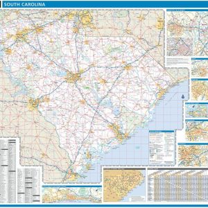
This colorful, easy-to-read state map of South Carolina identifies all major thoroughfares, secondary roads, freeway interchanges, rest areas, distance markers, landmarks, recreational areas, and more. Shaded relief on the state map provides a three-dimensional sense of South Carolina s topography. Detailed city inset maps of Charleston, Columbia, Greenville-Spartanburg, and Myrtle Beach are based on the…
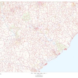
This map of South Carolina shows ZIP codes overlaid on a road map. Base map features include municipality and county boundaries, major road network features, and state and national parks and conservation areas. This map is rolled and shipped in a sturdy cardboard tube.
This map has been created and designed for business or reference use. Clear and clean colors & fonts matched with cartographic research makes this South Carolina Zip Code Map with Counties easily readable and useful. The map shows the 46 counties of South Carolina and the borders of the 421 zip codes across the Palmetto…
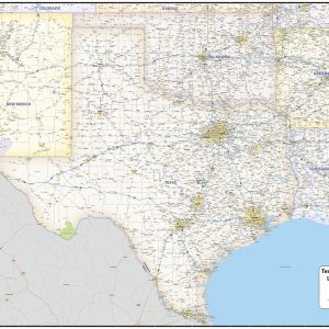
Includes Counties, Cities, Highways, Points of Interest Full Coverage TX, AR, OK, NM, LA This beautiful South Central United States wall map shows all of Arkansas, Louisiana, New Mexico, Oklahoma and Texas with partial coverage of surrounding states. The map features state, US and interstate highways, rivers and lakes, national forests, state lines, counties, cities…
Laminated with Hanging Rails 60 W x 46 H Index of Counties and Cities Fully Indexed Counties, Cities, Mileage Chart Inset Maps of All Major Cities Free Shipping! This map is rolled and shipped in a sturdy cardboard tube.
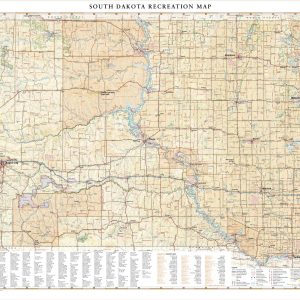
South Dakota is home to the famous Black Hills National Forest and Mount Rushmore National Monument, iconic attractions for road travelers around the world. This map illustrates the public lands and recreation potential of South Dakota, from Deadwood and Sturgis to its eastern capital in Sioux Falls. If outdoor adventure and recreation is your thing,…
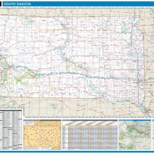
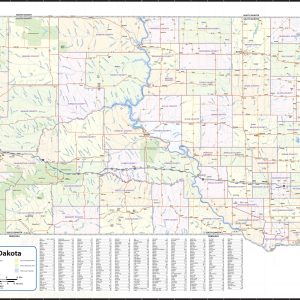
Wall map of South Dakota, showing counties, towns, cities, villages, major roads and highways. Includes community index. This map comes in a variety of sizes and finishing options. It is shipped rolled in a sturdy cardboard tube.
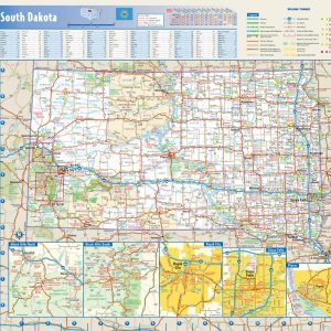
This colorful, easy-to-read state map of South Dakota identifies all major thoroughfares, secondary roads, freeway interchanges, rest areas, distance markers, landmarks, recreational areas, and more. Shaded relief on the state map provides a three-dimensional sense of South Dakota s topography. Detailed city inset maps of Pierre, Rapid City and Sioux Falls are based on the…
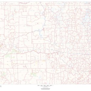
This map of South Dakota shows ZIP codes overlaid on a road map. Base map features include municipality and county boundaries, major road network features, and state and national parks and conservation areas. This map is rolled and shipped in a sturdy cardboard tube.
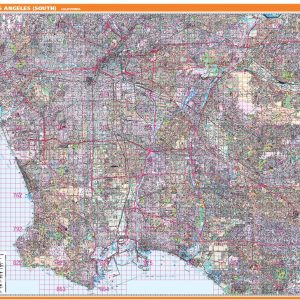
Rand McNally s ProSeries wall map of South Los Angeles is ideal for anyone needing a comprehensive representation of the area for planning, routing, or reference. It s a great choice for business and sales strategy, urban development, social work outreach, education, and marketing. Note: This map is not available for gift wrapping. Please allow…
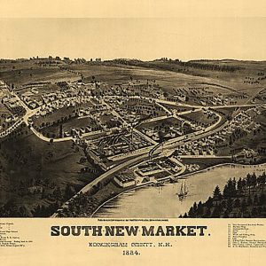
South New Market, New Hampshire by Norris & Wellge, 1884.This beautiful antique map reproduction is printed on heavy acid-free stock with fade proof inks and is excellent for framing. 24 W x 18 H
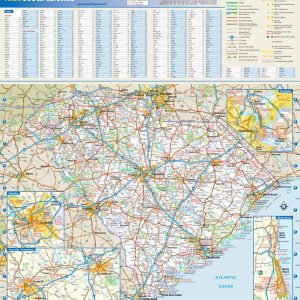
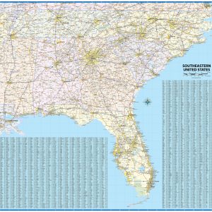
Regional laminated wall map covering the southeastern United States, including North Carolina, South Carolina, Georgia, Florida, Alabama, Mississippi, Tennessee, and adjacent areas of surrounding states. Features shown include states, counties, cities, and major highways. An index of place names is included so that users can quickly locate cities and towns.
End of content
End of content
No products in the cart.