This colorful, easy-to-read state map of North Dakota identifies all major thoroughfares, secondary roads, freeway interchanges, rest areas, distance markers, landmarks, recreational areas, and more. Shaded relief on the state map provides a three-dimensional sense of North Dakota s topography. Detailed city inset maps of Bismarck, Fargo and Grand Forks are based on the latest…
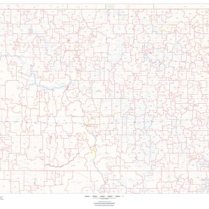
This map of North Dakota shows ZIP codes overlaid on a road map. Base map features include municipality and county boundaries, major road network features, and state and national parks and conservation areas. This map is rolled and shipped in a sturdy cardboard tube.
Rand McNally s ProSeries wall map of North Los Angeles is ideal for anyone needing a comprehensive representation of the area for planning, routing, or reference. It s a great choice for business and sales strategy, urban development, social work outreach, education, and marketing. Note: This map is not available for gift wrapping. Please allow…
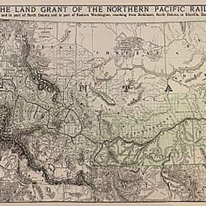
Northern Pacific Railroad Company by Rand McNally & Company, 1890This beautiful antique map reproduction is printed on heavy acid-free stock with fade proof inks and is excellent for framing. 39 W x 20 H
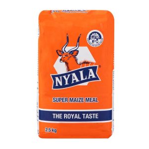
NYALA® Super Maize Meal is naturally high in energy and fortified with vitamins and minerals for better health. 2.5 Kg Source of vitamins and minerals High in Energy NYALA® How to Use This super maize meal can be made into a thick porridge, which is used in many cultures as a staple food
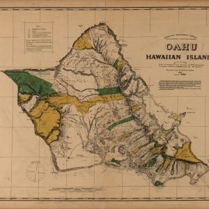
This beautiful antique map reproduction is printed on heavy acid-free stock with fade proof inks and is excellent for framing. Relief on the map is shown using hachures and spot heights. Copyright Hawaiian Government Survey, 1881 Size: 36 × 29
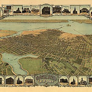
Oakland, California by Fred Soderberg, 1900This beautiful antique map reproduction is printed on heavy acid-free stock with fade proof inks and is excellent for framing. 35 W x 23 H
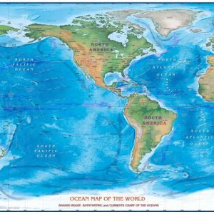
Bathymetry and currents Physical Terrain Ocean Relief Beautifully illustrated with subtle earth tone hues, the detail is highly legible with country borders clearly defined. In classic Atlas style, this map can be used for general reference, to track current events, or as a piece of art.Decorators will find the color scheme works beautifully with most…
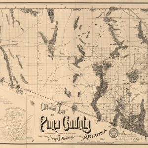
This beautiful antique map reproduction is printed on heavy acid-free stock with fade proof inks and is excellent for framing. Copyright George J. Roskruge, 1893 Size: 50 × 27
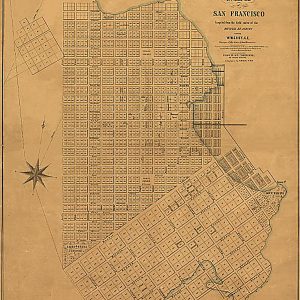
Official map of San Francisco by Alex Zakrzewski, 1849This beautiful antique map reproduction is printed on heavy acid-free stock with fade proof inks and is excellent for framing. 20 W x 25 H
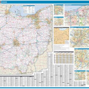
Laminated with Hanging Rails 60 W x 46 H Index of Counties and Cities Fully Indexed Counties, Cities, Mileage Chart Inset Maps of All Major Cities Free Shipping! This map is rolled and shipped in a sturdy cardboard tube.
This map has been created and designed for reference or business use. Clear and clean colors & fonts matched with cartographic research makes this map of Ohio Counties Map easily readable and useful. The map shows the 88 counties of Ohio and their borders across the Buckeye State. This map is rolled and shipped in…
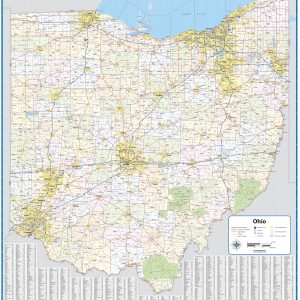
Wall map of Ohio, showing counties, towns, cities, villages, major roads and highways. Includes community index. This map comes in a variety of sizes and finishing options. It is shipped rolled in a sturdy cardboard tube.