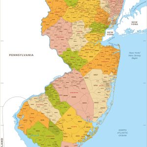
This map has been created and designed for business or reference use. Clear and clean colors & fonts matched with cartographic research makes this New Jersey Zip Code Map with Counties easily readable and useful. The map shows the 21 counties of New Jersey and the borders of the 759 zip codes across the Garden…
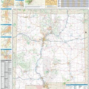
New Mexico’s unique desert-to-mountain landscapes and rich cultural heritage earn its nickname the Land of Enchantment. This wall map illustrates the terrain features, public lands, and roadways that connect the desert southwest with the southern reaches of the Rocky Mountains. If outdoor adventure and recreation is your thing, this is the map for you. This…
This colorful, easy-to-read state map of New Mexico identifies all major thoroughfares, secondary roads, freeway interchanges, rest areas, distance markers, landmarks, recreational areas, and more. Shaded relief on the state map provides a three-dimensional sense of New Mexico’s topography. Detailed city inset maps of Albuquerque, Las Cruces, Roswell, and Santa Fe are based on the…
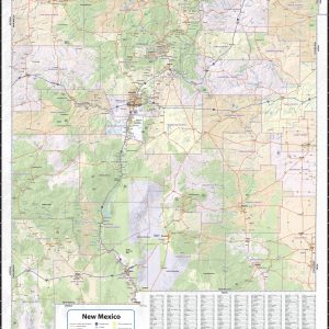
This exquisite wall map of New Mexico uses shaded relief to portray the land and combines shading with elevation tints that portray landforms much more clearly than contour lines. These techniques and elevation colors make mountains, highlands and valleys immediately obvious. This map also includes a city index making this map both highly functional and…
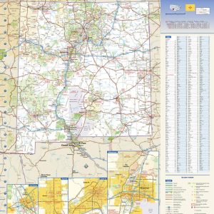
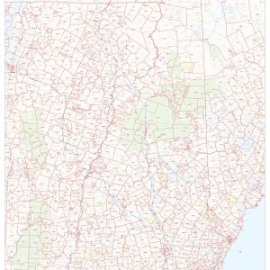
This map of New Mexico shows ZIP codes overlaid on a road map. Base map features include county boundaries, major road network features, and state and national parks and conservation areas. This map is rolled and shipped in a sturdy cardboard tube.
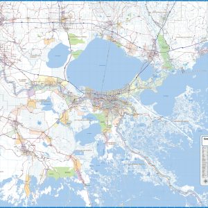
Wall map of the New Orleans Metro Area showing locations within 45 – 60 miles of downtown New Orleans, including the area from Baton Rouge to Gulfport, south to the Gulf. The map covers much of East Baton Rouge Parish, Livingston Parish, southern Tangipahoa Parish, St. Tammany Parish, Ascension Parish, St. James Parish, St. John the…
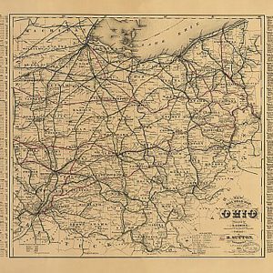
New rail road map of Ohio prepared by H. Sabine, Commissioner of Rail Roads & Telegraphs, 1882This beautiful antique map reproduction is printed on heavy acid-free stock with fade proof inks and is excellent for framing. 27 W x 21 H
New York and Brooklyn by Parsons & Atwater, pub. by Currier & Ives, 1892This beautiful antique map reproduction is printed on heavy acid-free stock with fade proof inks and is excellent for framing. 27 W x 20 H
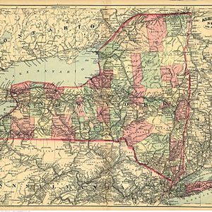
New York and part of Ontario by Asher & Adams, 1871.This beautiful antique map reproduction is printed on heavy acid-free stock with fade proof inks and is excellent for framing. 27 W x 20 H
New York by G. Schlegel, 1873.This beautiful antique map reproduction is printed on heavy acid-free stock with fade proof inks and is excellent for framing. 25 W x 18 H
New York by G. Schlegel, pub. by Tamsen & Dethlefs, 1874This beautiful antique map reproduction is printed on heavy acid-free stock with fade proof inks and is excellent for framing. 27 W x 20 H
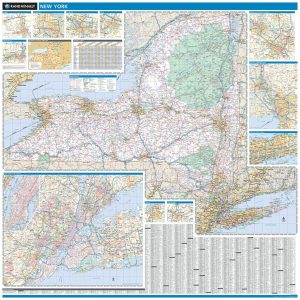
This colorful, easy-to-read state map of New York identifies all major thoroughfares, secondary roads, freeway interchanges, rest areas, distance markers, landmarks, recreational areas, and more. Shaded relief on the state map provides a three-dimensional sense of New York s topography. Detailed city inset maps of Albany, Binghamton, Buffalo, New York City, Rochester, Syracuse, and Utica…
Laminated with Hanging Rails 60 W x 60 H Index of Counties and Cities Fully Indexed Counties, Cities, Mileage Chart Inset Maps of All Major Cities Free Shipping! This map is rolled and shipped in a sturdy cardboard tube.
New York by Root & Tinker, 1879This beautiful antique map reproduction is printed on heavy acid-free stock with fade proof inks and is excellent for framing. 20 W x 27 H
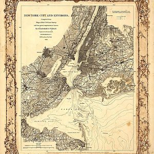
New York City and Environs, 1860This beautiful antique map reproduction is printed on heavy acid-free stock with fade proof inks and is excellent for framing. 18 W x 22 H