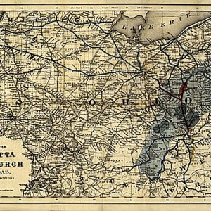

Marietta and Pittsburgh Railroad, 1871 Sale
$19.98Marietta and Pittsburgh Railroad, 1871This beautiful antique map reproduction is printed on heavy acid-free stock with fade proof inks and is excellent for framing. 32 W x 20 H
FREE RETURNS. STANDARD SHIPPING ORDERS $99+
Showing 785–800 of 5124 results
Marietta and Pittsburgh Railroad, 1871This beautiful antique map reproduction is printed on heavy acid-free stock with fade proof inks and is excellent for framing. 32 W x 20 H
Experience the difference in taste that only a premium blend can provide with this high-quality braai salt. Crafted from the finest ingredients, it ensures that every pinch adds the perfect amount of flavour to your dishes. It s also versatile enough to be used in other dishes like soups and stews. Instantly enhance the flavour…
Marina Braai Salt with Peri Peri, 400g
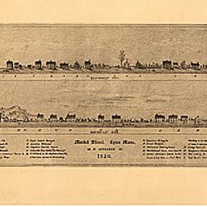
Market Street, Lynn, Mass., as it appeared in 1820 by William T. OliverThis beautiful antique map reproduction is printed on heavy acid-free stock with fade proof inks and is excellent for framing. 23 W x 10 H
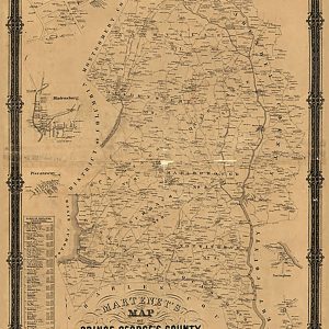
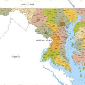
Martenet s Map of Prince George s County, Maryland.Martenet, Simon J. CREATED PUBLISHED Baltimore, 1861This beautiful antique map reproduction is printed on heavy acid-free stock with fade proof inks and is excellent for framingMartenet s Map of Prince George s County, Maryland.Martenet, Simon J. CREATED PUBLISHED Baltimore, 1861 This beautiful antique map reproduction is printed…
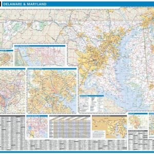
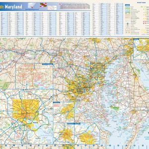
Laminated with Hanging Rails 46 W x 60 H Index of Counties and Cities Fully Indexed Counties, Cities, Mileage Chart Inset Maps of All Major Cities Free Shipping! This map is rolled and shipped in a sturdy cardboard tube.
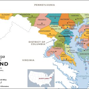
This map has been created and designed for reference or business use. Clear and clean colors & fonts matched with cartographic research makes this map of Maryland Counties Map easily readable and useful. The map shows the 64 counties of Maryland and their borders across the Old Line State. This map is rolled and shipped…
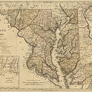
Maryland und Delaware. W. Sander, sculp.Sotzmann, D. F. CREATED PUBLISHED Hamburg, C. E. Bohn, 1797. This beautiful antique map reproduction is printed on heavy acid-free stock with fade proof inks and is excellent for framingMaryland und Delaware. W. Sander, sculp.Sotzmann, D. F. CREATED PUBLISHED Hamburg, C. E. Bohn, 1797. This beautiful antique map reproduction is printed on…
This colorful, easy-to-read state map of Maryland identifies all major thoroughfares, secondary roads, freeway interchanges, rest areas, distance markers, landmarks, recreational areas, and more. Shaded relief on the state map provides a three-dimensional sense of Maryland s topography. Detailed city inset maps of Annapolis, Baltimore, Cumberland, Frederick, and Hagerstown are based on the latest street…
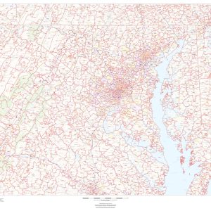
This map of Maryland shows ZIP codes overlaid on a road map. Base map features include municipality and county boundaries, major road network features, and state and national parks and conservation areas. This map is rolled and shipped in a sturdy cardboard tube.
This map has been created and designed for business or reference use. Clear and clean colors & fonts matched with cartographic research makes this Maryland Zip Code Map with Counties easily readable and useful. The map shows the 24 counties of Maryland and the borders of the 467 zip codes across the Old Line State….
Massachusetts by Bernard Romans, 1775This beautiful antique map reproduction is printed on heavy acid-free stock with fade proof inks and is excellent for framing. 20 W x 22 H
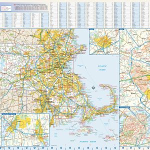
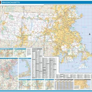
This colorful, easy-to-read state map of Massachusetts identifies all major thoroughfares, secondary roads, freeway interchanges, rest areas, distance markers, landmarks, recreational areas, and more. Shaded relief on the state map provides a three-dimensional sense of Massachusetts topography. Detailed inset maps of Boston, Lowell, New Bedford Fall River, Springfield and Worcester are based on the latest…
Laminated with Hanging Rails 60 W x 46 H Index of Counties and Cities Fully Indexed Counties, Cities, Mileage Chart Inset Maps of All Major Cities Free Shipping! This map is rolled and shipped in a sturdy cardboard tube.
This map has been created exclusively and designed for reference or business use. Clear and clean colors & fonts matched with cartographic research makes this map of Massachusetts Counties Map easily readable and useful. The map shows the 14 counties of Massachusetts and their borders across the Bay State. This map is rolled and shipped…
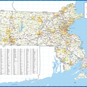
Laminated wall map of Massachusetts, showing counties, towns, cities, villages, major roads and highways. A community index is included. This map comes in a variety of sizes and finishing options. It is shipped rolled in a sturdy cardboard tube.
End of content
End of content
No products in the cart.