Map of the rail-roads of the state of New York, 1857.This beautiful antique map reproduction is printed on heavy acid-free stock with fade proof inks and is excellent for framing. 27 W x 21 H
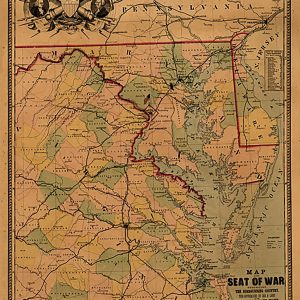
Map of the seat of war exhibiting the surrounding country, the approaches by sea & land to the capitol of the United States, and the military posts, forts, &c.General map of eastern Virginia, Maryland, and Delaware.Includes Table of distances from Washington by rail road.This beautiful antique map reproduction is printed on heavy acid-free stock with…
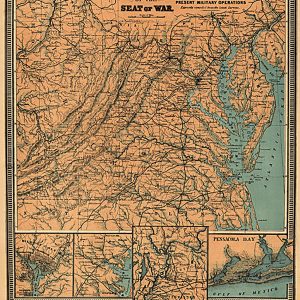
Map of the seat of war. Supplement to P. S. Duval & Son s military map, showing the locations of the present military operations expressly compiled from the latest surveys.General map of Virginia, Maryland, and Delaware.Insets: Washington, D.C., Baltimore and vicinity, Parts of the Ohio and Mississippi rivers above Memphis, Pensacola Bay.This beautiful antique map…
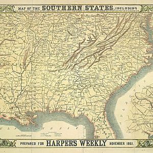
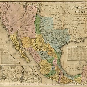
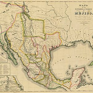
Map of the southern states, including rail roads, county towns, state capitals, county roads…, 1861This beautiful antique map reproduction is printed on heavy acid-free stock with fade proof inks and is excellent for framing. 26 W x 18 H
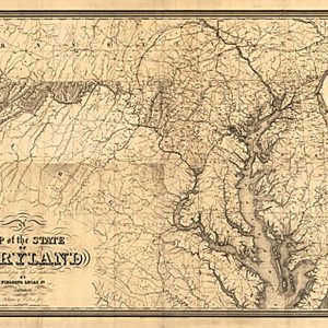
Map of the State of Maryland. Constructed from the best authorities by Fielding Lucas, Jr. Engraved by John Warr.Lucas, Fielding, Jr., 1781-1854. CREATED PUBLISHED Baltimore, 1841This beautiful antique map reproduction is printed on heavy acid-free stock with fade proof inks and is excellent for framingMap of the State of Maryland. Constructed from the best authorities…
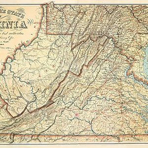
Map of the state of Virginia, 1863This beautiful antique map reproduction is printed on heavy acid-free stock with fade proof inks and is excellent for framing. 35 W x 23 H
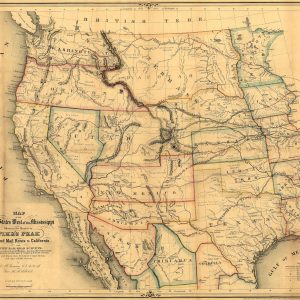
PUB. DATE: 1859FULL TITLE: Map of the United States west of the Mississippi showing the routes to Pike s Peak, overland mail route to California and Pacific rail road surveys. To which are added the new state & territorial boundaires, the principal mail & rail road routes with all the arrangements & corrections made by…
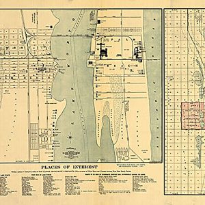
Map of West Palm Beach, Lake Worth, and Palm Beach, Florida, 1907 This beautiful antique map reproduction is printed on heavy acid-free stock with fade proof inks and is excellent for framing. 26 W x 20 H
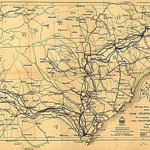
Map showing route of marches of the army of Genl. W.T. Sherman, from Atlanta, Ga. to Goldsboro, N.C.This beautiful antique map reproduction is printed on heavy acid-free stock with fade proof inks and is excellent for framing. 24 W x 16 H
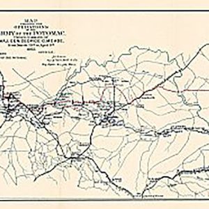
Map showing the operations of the Army of the Potomac under command of Maj. Gen. George G. Meade from March 29th to April 9th 1865This beautiful antique map reproduction is printed on heavy acid-free stock with fade proof inks and is excellent for framing. 32 W x 12 H
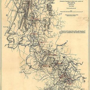
Map showing the operations of the national forces under the command of Maj. Gen. W.T. Sherman during the campaign resulting in the capture of Atlanta, Georgia, Sept. 1, 1864This beautiful antique map reproduction is printed on heavy acid-free stock with fade proof inks and is excellent for framing. 16 W x 24 H
Map showing the Seaboard, Pennsylvania and Western Railroad and its connections by G.W. & C.B. Colton & Co., 1884This beautiful antique map reproduction is printed on heavy acid-free stock with fade proof inks and is excellent for framing. 28 W x 24 H
Maps of the battlefield of Gettysburg, July 1st, 2nd & 3rd (one map for each day), 1863This beautiful antique map reproduction is printed on heavy acid-free stock with fade proof inks and is excellent for framing. 26 W x 33 H
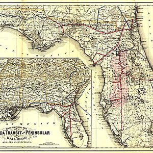
Maps showing the Florida Transit and Peninsula Rail Road and its connections, 1882 This beautiful antique map reproduction is printed on heavy acid-free stock with fade proof inks and is excellent for framing. 31 W x 22 H