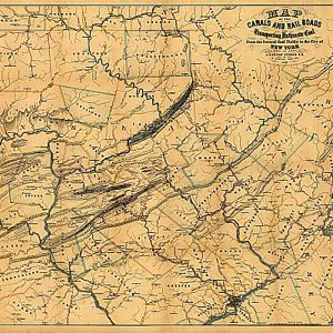
Map of the canals and railroads for transporting coal from the several coal fields to the city of New York, 1856This beautiful antique map reproduction is printed on heavy acid-free stock with fade proof inks and is excellent for framing. 33 W x 26 H
Map of the city and county of Baltimore, Maryland. From original surveys by J.C. Sidney, C.E.Sidney, J. C. (James C.)CREATED PUBLISHED Baltimore, James M. Stephens, c1857.This beautiful antique map reproduction is printed on heavy acid-free stock with fade proof inks and is excellent for framingMap of the city and county of Baltimore, Maryland. From original surveys…
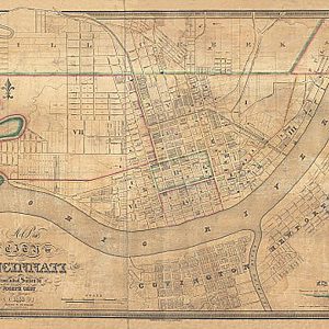
Map of the city of Cincinnati from actual survey by Joseph Gest, 1838This beautiful antique map reproduction is printed on heavy acid-free stock with fade proof inks and is excellent for framing. 32 W x 23 H
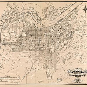
Map of the city of Louisville, Kentucky, New Albany & Jeffersonville, Indiana by Wm. C. Coghlan, 1873This beautiful antique map reproduction is printed on heavy acid-free stock with fade proof inks and is excellent for framing. 24 W x 27 H
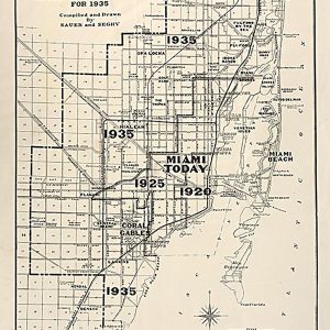
Map of the city of Miami and environs showing the greater Miami development and the estimated expansion for 1935 This beautiful antique map reproduction is printed on heavy acid-free stock with fade proof inks and is excellent for framing. 14 W x 25 H
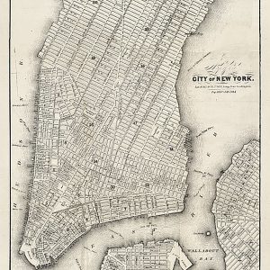
Map of the city of New York, 1860This beautiful antique map reproduction is printed on heavy acid-free stock with fade proof inks and is excellent for framing. 17 W x 24 H
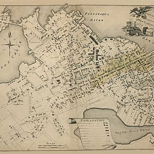
Map of the compact part of the town of Portsmouth in the state of New Hampshire by J.G. Hales, 1813.This beautiful antique map reproduction is printed on heavy acid-free stock with fade proof inks and is excellent for framing. 34 W x 25 H
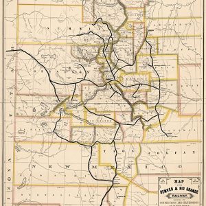
Map of the Denver & Rio Grande Railway, showing its connections and extensions also the relative position of Denver and Pueblo to all the principal towns and mining regions of Colorado and New Mexico. Outline map of Colorado and New Mexico showing major relief by hachures, major drainage, cities and towns, and county boundaries. Main…
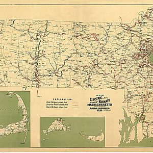
Map of the electric railways of the state of Massachusetts accompanying the report of the railroad commissioners by Geo. H. Walker & Co., 1899This beautiful antique map reproduction is printed on heavy acid-free stock with fade proof inks and is excellent for framing. 36 W x 25 H
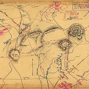
Map of the environs of Pine Mountain, Lost Mountain, Kenesaw Mountain, and Little Kenesaw Mountain by G. H. Blakeslee T. E., June 2-22, 1864This beautiful antique map reproduction is printed on heavy acid-free stock with fade proof inks and is excellent for framing. 24 W x 18 H
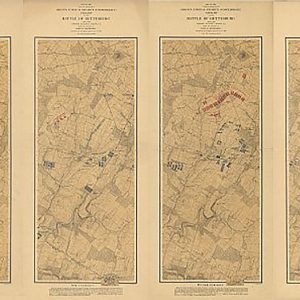
Map of the field of operations of Gregg s (Union) & Stuart s (Confederate) cavalry at the battle of Gettysburg, July 3rd, 1863This beautiful antique map reproduction is printed on heavy acid-free stock with fade proof inks and is excellent for framing. 40 W x 24 H
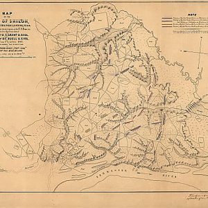
Map of the field of Shiloh, near Pittsburgh Landing, Tenn. on the 6th and 7th of April 1862This beautiful antique map reproduction is printed on heavy acid-free stock with fade proof inks and is excellent for framing. 27 W x 20 H
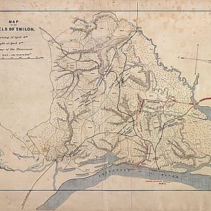
Map of the field of Shiloh. April 6, 1862This beautiful antique map reproduction is printed on heavy acid-free stock with fade proof inks and is excellent for framing. 27 W x 20 H
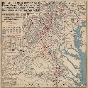
Map of the Main Battlefields, Routes, Camps and Head Qrs., in the Gettysburg, Wilderness and Appomattox campaignsThis beautiful antique map reproduction is printed on heavy acid-free stock with fade proof inks and is excellent for framing. 27 W x 26 H
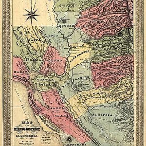
Map of the Mining District of California by William A. Jackson, 1851This beautiful antique map reproduction is printed on heavy acid-free stock with fade proof inks and is excellent for framing. 20 W x 24 H
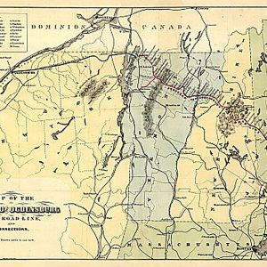
Map of the Portland and Ogdensburg Rail Road line, and connections, 185?This beautiful antique map reproduction is printed on heavy acid-free stock with fade proof inks and is excellent for framing. 27 W x 19 H