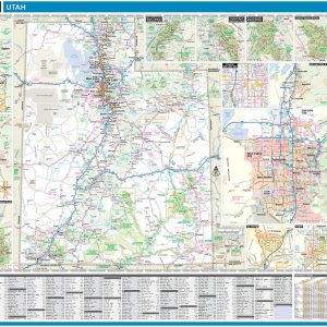
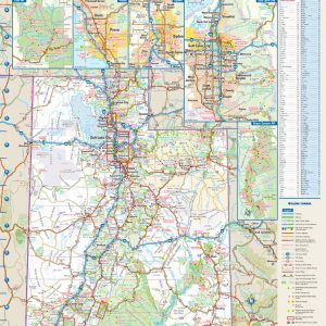
Laminated with Hanging Rails 60 W x 46 H Index of Counties and Cities Fully Indexed Counties, Cities, Mileage Chart Inset Maps of All Major Cities Free Shipping! This map is rolled and shipped in a sturdy cardboard tube.
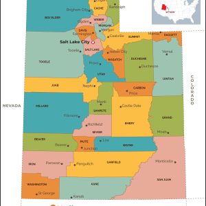
This map has been created and designed for reference or business use. Clear and clean colors & fonts matched with cartographic research makes this map of Utah Counties Map easily readable and useful. The map shows the 29 counties of Utah and their borders across the Beehive State. This map is rolled and shipped in…
Utah boasts what is perhaps the best concentration of national parks in the world, known as The Mighty Five: Zion, Bryce Canyon, Capitol Reef, Canyonlands, and Arches. These diverse and iconic desert landscapes, along with the Great Salt Lake and world-class alpine skiing in the north, draw travelers to The Beehive State year-round. If outdoor…
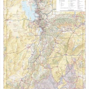
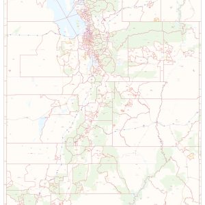
Wall map of Utah, showing counties, towns, cities, villages, major roads and highways. A community index is included. This map comes in a variety of sizes and finishing options. It is shipped rolled in a sturdy cardboard tube.
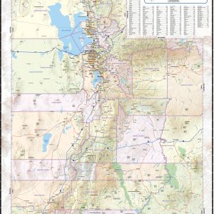
This colorful, easy-to-read state map of Utah identifies all major thoroughfares, secondary roads, freeway interchanges, rest areas, distance markers, landmarks, recreational areas, and more. Shaded relief on the state map provides a three-dimensional sense of Utah’s topography. Detailed city inset maps of Provo, Ogden, and Salt Lake City are based on the latest street information…
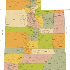
This map of Utah shows ZIP codes overlaid on a road map. Base map features include municipality and county boundaries, major road network features, and state and national parks and conservation areas. This map is rolled and shipped in a sturdy cardboard tube.
This map has been created exclusively and designed for business or reference use. Clear and clean colors & fonts matched with cartographic research makes this Utah Zip Code Map with Counties easily readable and useful. The map shows the 29 counties of Utah and the borders of the over 200 zip codes across the Beehive…
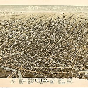
Utica, New York by H. Brosius, 1873.This beautiful antique map reproduction is printed on heavy acid-free stock with fade proof inks and is excellent for framing. 28 W x 21 H
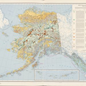
This beautiful antique map reproduction is printed on heavy acid-free stock with fade proof inks and is excellent for framing. The map features prominent vegetation groups and their distribution throughout the state of Alaska as well as an index that describes each group. Copyright 1963 Size: 48 × 35
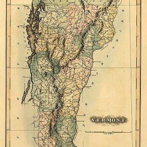
Vermont by Fielding Lucas, 1826This beautiful antique map reproduction is printed on heavy acid-free stock with fade proof inks and is excellent for framing. 16 W x 20 H
Laminated with Hanging Rails 46 W x 60 H Index of Counties and Cities Fully Indexed Counties, Cities, Mileage Chart Inset Maps of All Major Cities Free Shipping! This map is rolled and shipped in a sturdy cardboard tube.
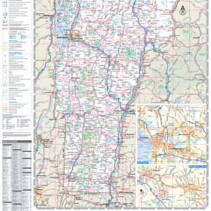
This map of Vermont shows ZIP code areas overlaid on a road map. Ideal for planning of deliveries, home services, sales territories, real estate and much more. Base map features include all roads with major roads and highways labelled, municipality and county boundaries, neighborhood names, railways, and high level land use such as parks and…
Vermont, from actual survey, 1814This beautiful antique map reproduction is printed on heavy acid-free stock with fade proof inks and is excellent for framing. 16 W x 20 H
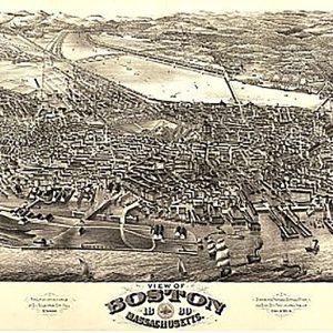
View of Boston, Massachusetts by H.H. Rowley & Co., 1880.This beautiful antique map reproduction is printed on heavy acid-free stock with fade proof inks and is excellent for framing. 35 W x 20 H
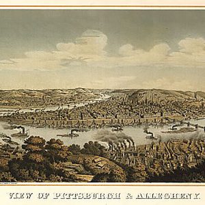
View of Pittsburgh & Allegheny by Otto Krebs, 1874This beautiful antique map reproduction is printed on heavy acid-free stock with fade proof inks and is excellent for framing. 30 W x 18 H
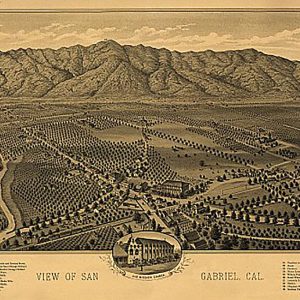
View of San Gabriel, California by D D Morse, 1893This beautiful antique map reproduction is printed on heavy acid-free stock with fade proof inks and is excellent for framing. 27 W x 18 H