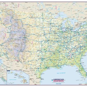
Perfect for home, business, or school, this US Interstate Highways wall map shows the Interstate Highway System of the United States, along with other important Federal and state highways. Details included on this wall map consist of: international and state provincial boundaries, freeways, tollways and other major roads; cities and towns; time zones; and all…
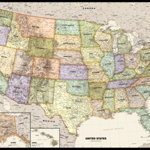
Perfect for home, business, or school, this Legacy USA Wall Map combines bright, attractive colors with high-detailed cartography in an antique style. Details on this United States Wall Map include: state boundaries and capitals along with other major cities and towns; major physical features such as mountain ranges and major mountain peaks; major water features…
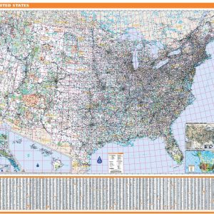
This map has been created and designed for reference or business use. Clear and clean colors & fonts matched with cartographic research makes this map of USA Map wth County Names easily readable and useful. The map shows the the over 3,000 counties, parishes and boroughs of the United States and their borders.
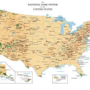
Perfect for home, business, or school, this US National Park Service wall map shows the location of all sites operated by the National Park system in the continental United States, Alaska, Hawaii, Puerto Rico and the U.S. Virgin Islands.
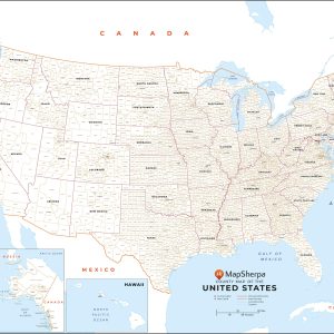
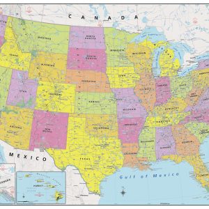
Created specifically for MapSherpa, this United States Political Map stretches from the Pacific to the Atlantic Oceans, and the Gulf of Mexico to international neighbor borders, this US Political Map displays all 50 states that make up the country. For readability, each state is easily identified by a different color, the map prominently shows; State…
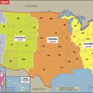
Clear and colorful, the USA Time Zone Map shows what time it is in the different time zones across the United States. The map notes all the 50 states and the time zones they fall into. Plus, it includes two small inset maps for Alaska and Hawaii, as each has its own time zones. The…
Rand McNally s ProSeries United States Wall Map is an irreplaceable reference tool for anyone needing a comprehensive representation of the country for planning, routing, or reference. The large size and detailed laminated map make it a great addition to any office or board room. Map indications include: Interstates, federal highways, and state highways…
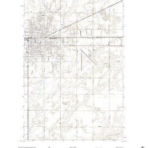
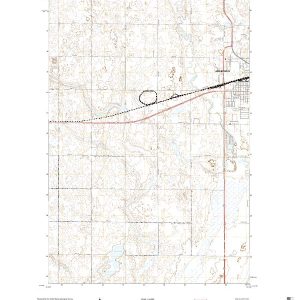
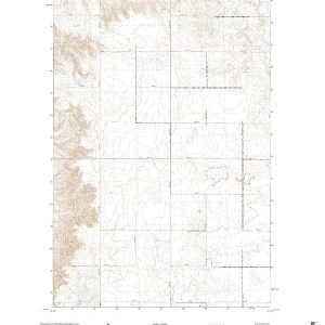
This is the current USGS topographic map for this quadrangle. Printed on waterproof, crease resistant paper, using HP fade resistant inks, this map comes rolled and shipped in a sturdy carboard tube. The map contains contour data, water features, roads and other features. Scale is 1:24,000. Printed size is 24 W x 29 H
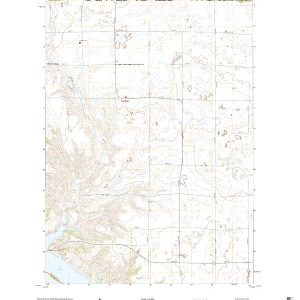
This is the current USGS topographic map for this quadrangle. Printed on waterproof, crease resistant paper, using HP fade resistant inks, this map comes rolled and shipped in a sturdy carboard tube. The map contains contour data, water features, roads and other features. Scale is 1:24,000. Printed size is 24 W x 29 H
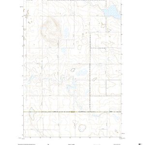
This is the current USGS topographic map for this quadrangle. Printed on waterproof, crease resistant paper, using HP fade resistant inks, this map comes rolled and shipped in a sturdy carboard tube. The map contains contour data, water features, roads and other features. Scale is 1:24,000. Printed size is 24 W x 29 H
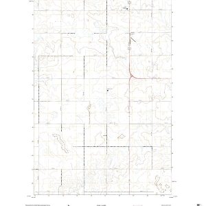
This is the current USGS topographic map for this quadrangle. Printed on waterproof, crease resistant paper, using HP fade resistant inks, this map comes rolled and shipped in a sturdy carboard tube. The map contains contour data, water features, roads and other features. Scale is 1:24,000. Printed size is 24 W x 29 H
This is the current USGS topographic map for this quadrangle. Printed on waterproof, crease resistant paper, using HP fade resistant inks, this map comes rolled and shipped in a sturdy carboard tube. The map contains contour data, water features, roads and other features. Scale is 1:24,000. Printed size is 24 W x 29 H
This is the current USGS topographic map for this quadrangle. Printed on waterproof, crease resistant paper, using HP fade resistant inks, this map comes rolled and shipped in a sturdy carboard tube. The map contains contour data, water features, roads and other features. Scale is 1:24,000. Printed size is 24 W x 29 H
This is the current USGS topographic map for this quadrangle. Printed on waterproof, crease resistant paper, using HP fade resistant inks, this map comes rolled and shipped in a sturdy carboard tube. The map contains contour data, water features, roads and other features. Scale is 1:24,000. Printed size is 24 W x 29 H
This is the current USGS topographic map for this quadrangle. Printed on waterproof, crease resistant paper, using HP fade resistant inks, this map comes rolled and shipped in a sturdy carboard tube. The map contains contour data, water features, roads and other features. Scale is 1:24,000. Printed size is 24 W x 29 H
This is the current USGS topographic map for this quadrangle. Printed on waterproof, crease resistant paper, using HP fade resistant inks, this map comes rolled and shipped in a sturdy carboard tube. The map contains contour data, water features, roads and other features. Scale is 1:24,000. Printed size is 24 W x 29 H